Happy Parking!

Project Info

Pakers thumbnail

Team Name


Pakers


Team Members


6 members with unpublished profiles.

Project Description


The Happy Parking! project aims to make the most use of the open-source data from government solving practical problems and tell stories of urban development according to historical car park data.

Part 1

Parkers aim to create a real-time web app for end-users, helping drivers to find a vacant spot efficiently.

It allows users to select the location they want to go and get them all vacant car parks in the area within 500 m and match the car park restrictions with duration they are willing to park. It has a priority rank for the matching function -- free first, within the area, outside area. If there are no vacant spots in this area, users can also use the off-street car park locations to find a car park.

At the government end, the real-time parking solution can help reduce the air pollution or traffic problem that caused by circling vehicles for vacant spaces as well as reduce the time wasted in finding a vacant spot, especially in the city area.

On the other hand, the visualization shows the land utilization in a more straightforward way, which supports the government to monitor and make a decision to improve quality of life.

Part 2

In addition, the web app also provides a visualization regarding the analysis of the parking area occupancy rate based on historical data of the past years.

It demonstrates the occupancy rate changes in each street with inground sensors according to their timestamps. Regarding these car park analysis data, it enables users to understand the urban planning in Melbourne and the changes in economic centres. Moreover, support the government’s urban planning decision in car parking, Remove car parks with low occupancy rate and build greenspace or improve public transportation network construction to reduce car park stress.
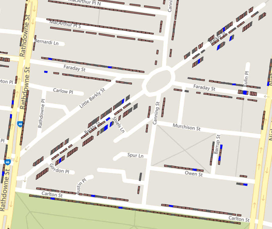

Data Story


The datasets provided by the City of Melbourne identifies the location of car park bay and vacancy in real-time told by in-ground sensor systems, which allow us to consolidate information and generate parking solutions for drivers.

For historical archived data, they give a knowledge about how well the parking systems are utilized, thus, the government could benefit from them to make a decision in respect to city resources planning.

we judged the occupancy rate on the peak hour(6:30-9: 00 am & 3:00-18: 30 pm) and whether it is the weekdays and weekends to make a comparison for each car par zone.


Evidence of Work

Video

Homepage

Team DataSets

Off-street car parks with capacity and type

Description of Use Getting the off-street car park location and capacity.

Data Set

On-street Car Parking Sensor Data - 2014

Description of Use Getting the on-street car park usage data in 2014

Data Set

On-street Car Parking Sensor Data - 2015

Description of Use Getting the on-street car park usage data in 2015

Data Set

On-street Car Parking Sensor Data - 2016

Description of Use Getting the on-street car park usage in 2016.

Data Set

On-street Car Parking Sensor Data - 2017

Description of Use Getting the on-street car park usage in 2017

Data Set

On-street Car Park Bay Restrictions

Description of Use Getting on-street car park bay restrictions.

Data Set

On-street Parking Bays

Description of Use Getting on-street car park bay locations.

Data Set

On-street Parking Bay Sensors

Description of Use Getting real-time on-street car park status.

Data Set

Challenge Entries

Telling Stories with Data(.Vic)

Accessing any of the datasets on data.vic, this challenge asks participants to extract and tell stories from data. Alternatively how might we facilitate citizens’ own inquiries and investigations via the Victorian Government Open Data Portal?

Go to Challenge | 21 teams have entered this challenge.

Work Life Made Easy

How can we make work life easier for employers and their workforces – now, and into the future?

Go to Challenge | 27 teams have entered this challenge.

Play Melbourne - A Creative City

This challenge aims to showcase Melbourne’s unique history and how the city’s landscape and iconic locations have changed over time.

Go to Challenge | 10 teams have entered this challenge.

My (Liveable) Victoria

Using the data available on Data Vic and My Victoria, how might well-being be represented and measured in Victoria?

Go to Challenge | 17 teams have entered this challenge.

More than apps and maps: help government decide with data

How can we combine data to help government make their big and small decisions? Government makes decisions every day—with long term consequences such as the location of a school, or on a small scale such as the rostering of helpdesk staff.

Go to Challenge | 58 teams have entered this challenge.

Innovation space - A City Planning for Growth

This challenge aims to showcase innovative new ways the city’s public space can be utilised and reimagined.

Go to Challenge | 8 teams have entered this challenge.

Bounty: Mix and Mashup

How can we combine the uncombinable?

Go to Challenge | 61 teams have entered this challenge.